How Hydrology Expert Witnesses Help Investigate Flooding and Drainage Disputes
Flooding and drainage disputes often turn on where water originated, how it moved, and whether natural conditions or human activities contributed to the damage. Hydrology expert witnesses help attorneys and claims professionals evaluate these questions using site evidence, water records, and engineering analysis.
This guide explains how hydrology experts investigate flooding, assess drainage conditions, and evaluate competing explanations for water-related damage.
When Hydrology Expert Witnesses Are Relevant in Litigation
Hydrology experts may assist attorneys in evaluating property damage allegations, construction deficiencies, and infrastructure management disputes involving flooding, drainage performance, or surface water movement.
Common disputes include:
Flood-related property damage: Evaluating whether rainfall, river overflow, altered runoff patterns, or drainage limitations contributed to flooding.
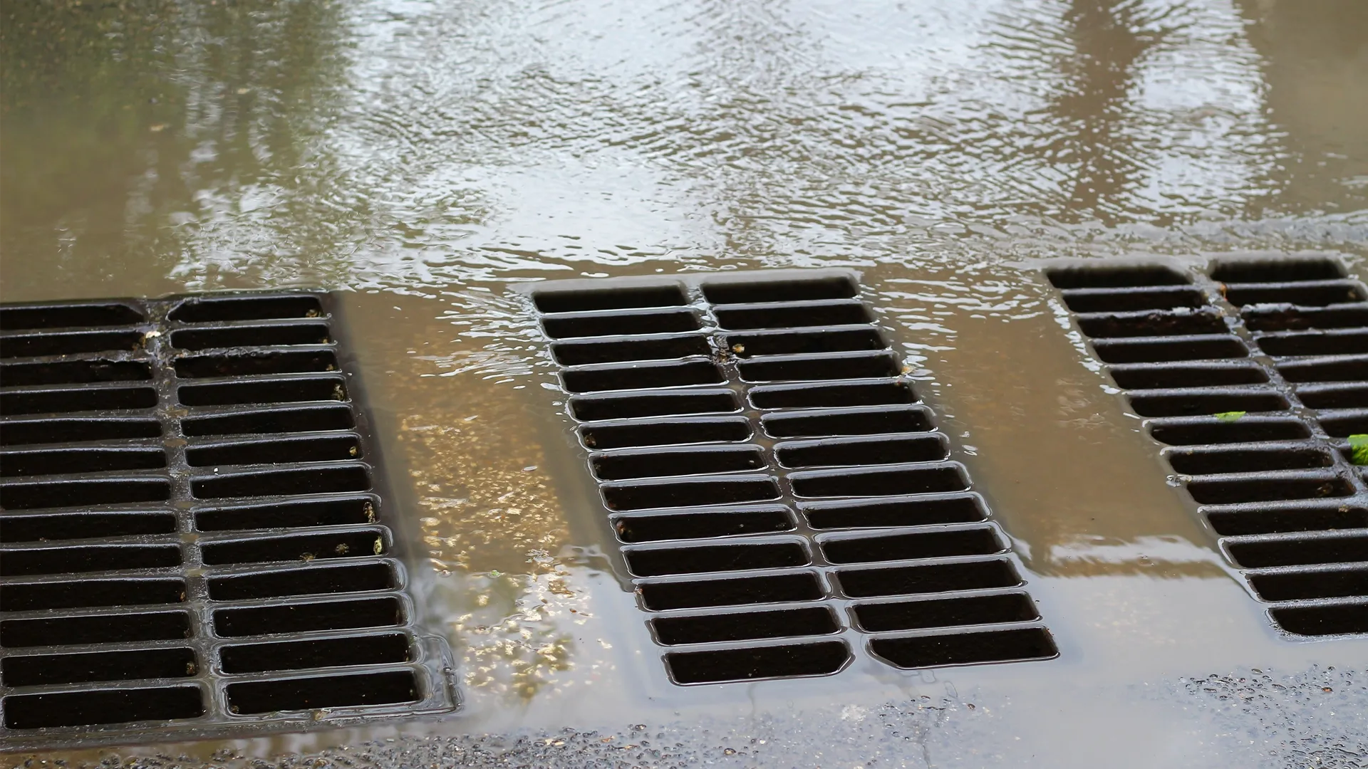
Stormwater drainage disputes: Assessing how storm drains, culverts, channels, or detention facilities performed under the conditions involved and whether their design or operation met applicable technical requirements.
Land development disputes: Examining whether grading, paving, or construction altered runoff volume, timing, or direction.
Municipal drainage disputes: Reviewing the design, operation, maintenance, or physical condition of public drainage infrastructure.
Flood control infrastructure disputes: Assessing the hydraulic performance of levees, channels, detention facilities, and other flood management structures.
Water-related construction disputes: Investigating whether site drainage, erosion, or redirected surface water contributed to alleged damage.
A key technical question is whether a condition changed water flow, accumulation, or discharge at the affected location, and to what extent. This assessment remains separate from legal determinations about negligence, liability, or damages.
How Hydrology Experts Investigate Flooding and Drainage Disputes
Hydrology experts may reconstruct conditions before and during a flood by examining precipitation, watershed runoff, terrain, infrastructure, and observed damage. The extent of the reconstruction depends on the available evidence.
Reconstructing Rainfall and Flood Conditions
An investigation may begin with rainfall records, storm duration, antecedent soil moisture, and available streamflow measurements.
The National Oceanic and Atmospheric Administration (NOAA) provides precipitation-frequency estimates through NOAA Atlas 14 for applicable locations. The United States Geological Survey (USGS) maintains historical and near-real-time water monitoring records. Together, these sources can help characterize storm conditions and watershed responses.
Experts may then compare rainfall and streamflow data with water levels, historical flood records, and documented flood marks.
Rainfall-frequency estimates provide statistical context, but they do not independently establish the severity of flooding at a particular property. Local runoff patterns, drainage infrastructure, and downstream conditions must also be considered.
Experts should distinguish precipitation-frequency data used to characterize a storm from the design criteria applicable to the project at the relevant time. Preliminary or subsequently revised estimates should not be treated as automatically controlling.
Evaluating Watershed Runoff and Land Development
Watershed characteristics affect how quickly rainfall becomes runoff and where it travels. Development may alter these patterns through paving, grading, drainage changes, or stormwater detention facilities.
A hydrology expert may compare historical and current site conditions using topographic surveys, aerial photographs, grading plans, soil information, and land-use records.
For example, where a property owner alleges that an adjacent development increased flooding, the expert may assess whether the project changed runoff volume, peak discharge, or drainage pathways toward the affected property.
The analysis must also consider other potential contributors. The fact that construction preceded a flood does not, by itself, establish that it caused the flooding.
Assessing Drainage System Design and Performance
Drainage investigations assess whether storm drains, culverts, catch basins, detention ponds, channels, pumps, and outfalls could collect, convey, or store runoff under the conditions involved.
The expert may review design calculations, construction drawings, as-built records, inspection reports, maintenance documentation, and information concerning blockages or deterioration.
This analysis can help distinguish among inadequate design capacity, construction differences, maintenance-related obstructions, downstream restrictions, and rainfall exceeding the system's design assumptions.
An observed overflow does not, by itself, establish that the drainage system was improperly designed or maintained.
Hydrologic and Hydraulic Modeling in Flood Causation Analysis
Hydrologic and hydraulic modeling can help experts reconstruct how runoff developed and how floodwater moved and accumulated. It can also help them compare alternative scenarios supported by the evidence.
Hydrologic analysis generally examines how precipitation, infiltration, and watershed characteristics influence the amount and timing of runoff. Hydraulic analysis examines how water moves through rivers, channels, pipes, floodplains, and other conveyance systems. Both may be needed to evaluate a complex flooding event.
Common Hydrologic and Hydraulic Modeling Tools
Experts may use several modeling systems documented by federal agencies, depending on the questions being investigated.
Hydrologic Engineering Center's Hydrologic Modeling System (HEC-HMS): Developed by the United States Army Corps of Engineers, HEC-HMS simulates watershed hydrologic processes, including precipitation-runoff relationships, infiltration, and flow routing.
Hydrologic Engineering Center's River Analysis System (HEC-RAS): Also developed by the United States Army Corps of Engineers, HEC-RAS supports hydraulic analysis of rivers, channels, floodplains, and other conveyance systems using one-dimensional and two-dimensional flow computations.
Storm Water Management Model (SWMM): Maintained by the United States Environmental Protection Agency (EPA), SWMM supports runoff and hydraulic analysis of stormwater and drainage networks, including pipes, channels, storage facilities, and other infrastructure.
The choice of model depends on watershed size, available data, drainage complexity, and the disputed flooding mechanism. No particular software is automatically appropriate for every investigation.
Comparing Alternative Flooding Scenarios
Experts may compare modeled water levels with and without a documented culvert obstruction. They may also evaluate runoff under supported predevelopment and postdevelopment conditions.
These comparisons can help assess possible changes in flood depth, flow direction, or timing. However, modeled results depend on their assumptions and do not establish causation merely because they support an allegation.
Evaluating Model Reliability and Uncertainty
Hydrologic and hydraulic models are not exact reproductions of physical events. Their reliability depends on input data, methods, boundary conditions, and comparisons with suitable observations when available. Experts should also explain limitations caused by missing data.
A study available through the USGS Publications Warehouse discusses how uncertainty in hydrologic data, topography, and hydraulic modeling assumptions can affect flood-inundation maps.
An expert should therefore explain relevant limitations, including:
Whether the model reflects conditions at the time of the event.
Whether rainfall, terrain, and infrastructure inputs are adequately supported.
Whether simulated results can be compared with observed flooding.
How sensitive conclusions are to uncertain parameters.
Whether alternative assumptions materially change the findings.
These considerations are particularly important when model results support a disputed causation opinion.
Floodplain Mapping and Drainage Standards in Litigation
Floodplain maps and drainage design criteria provide important context for water-related disputes, but they do not independently establish what caused a particular flood event.
Interpreting Floodplain Maps
The Federal Emergency Management Agency (FEMA) produces Flood Insurance Rate Maps used in flood hazard identification, insurance administration, and floodplain management.
These maps commonly identify areas with a 1-percent annual chance of flooding, often called the 100-year floodplain. This describes an annual probability, not a prediction that flooding occurs only once every 100 years. Properties outside mapped high-risk zones may also flood.
In litigation, a hydrology expert may review applicable flood maps, supporting flood studies, and historical map versions to understand documented flood hazards.
However, a floodplain designation alone does not establish the water depth, flow path, or cause of a specific flood event.
Evaluating Applicable Drainage Design Criteria
Drainage systems are commonly designed using criteria addressing runoff estimates, conveyance capacity, storage requirements, and selected design storm conditions. Applicable requirements depend on the jurisdiction, infrastructure, project approvals, and relevant time period.
Technical manuals, including the Federal Highway Administration's Urban Drainage Design Manual (HEC-22), provide guidance for particular drainage applications. HEC-22 addresses storm drainage associated with transportation facilities and should not be treated as a universally applicable or automatically binding design standard for all drainage systems.
An expert evaluating drainage performance may compare:
Applicable design standards and ordinances.
Approved drainage reports and engineering plans.
Construction and as-built records.
Documented maintenance and operating conditions.
Observed system performance during the event.
Engineering design requirements may arise from applicable laws, regulations, ordinances, permits, approved plans, or contractual obligations. Other technical guidance may inform engineering practice without independently establishing a legally binding requirement.
For example, 44 C.F.R. § 60.3 establishes minimum federal floodplain management criteria for communities participating in the National Flood Insurance Program. Those criteria concern floodplain management and development regulation and should not be treated as universally applicable stormwater system design specifications.
Whether applicable requirements were satisfied, whether professional standards were met, and whether legal responsibility exists are separate questions.
Compliance with a particular design storm criterion does not necessarily resolve every question concerning drainage performance. Conversely, flooding during a storm that exceeds a system's design assumptions does not independently establish a design defect or eliminate potential legal responsibility.
Evaluating Flood Causation and Competing Explanations
Flood causation analysis examines whether the observed damage is consistent with the alleged water source and whether other conditions contributed. Potential contributors include heavy rainfall, natural drainage limitations, increased runoff, obstructed infrastructure, and elevated downstream water levels. Experts may assess these factors using site observations, measurements, engineering calculations, and supported alternative scenarios.
For example, a property may experience flooding during an unusually intense storm while an obstructed drainage inlet also limits discharge capacity.
The expert may assess the obstruction's possible contribution, whether flooding would likely have occurred without it, and whether that contribution can be estimated from the available evidence.
In some cases, the evidence may point to one principal contributing mechanism. In others, several causes may remain plausible, and the evidence may not allow their effects to be reliably separated.
The presence of a drainage deficiency does not automatically establish that it caused the claimed damage.
A sound causation analysis should distinguish conclusions supported by physical evidence and measurements from those dependent on assumptions or subject to material uncertainty.
Evidence Hydrology Experts Review in Flooding and Drainage Disputes
Records of the reported flood and site conditions can help experts understand how water moved.
Relevant evidence commonly includes:
Meteorological records: Rainfall measurements, radar estimates, storm reports, and weather observations.
Hydrologic records: Streamflow measurements, water levels, watershed studies, and prior flooding information.
Site documentation: Surveys, elevation data, grading plans, photographs, and historical aerial imagery.
Engineering records: Drainage calculations, approved drawings, as-built plans, and hydraulic studies.
Infrastructure records: Inspection reports, maintenance logs, repair documentation, and records of reported blockages.
Loss documentation: Flood photographs, recorded water marks, damage surveys, incident reports, and witness statements.
Site inspections may also reveal sediment deposits, erosion patterns, and debris accumulation that help identify possible flow paths.
The USGS provides guidance on identifying and preserving high-water marks, which may assist in reconstructing flood elevations. However, the reliability of individual marks must be assessed because not every apparent water mark accurately represents the peak flood level.
Early documentation is particularly important when drainage structures are repaired, debris is removed, or site conditions change after the event.
Attorneys may also need to coordinate with structural engineers, geotechnical engineers, or other specialists when the dispute involves structural damage, groundwater intrusion, or property loss valuation.
Hydrology Expert Qualifications and Admissibility of Testimony
Hydrology expert testimony may assist courts in understanding technical questions concerning flood behavior, drainage capacity, and the physical contribution of alleged deficiencies.
Relevant professionals may include hydrologists, water resources engineers, and hydraulic engineers. Their qualifications should match the proposed opinions, as experience in watershed modeling does not necessarily establish expertise in stormwater infrastructure design.
In federal court proceedings governed by the Federal Rules of Evidence, Rule 702 governs the admissibility of expert testimony.
Rule 702 requires an expert to be qualified by knowledge, skill, experience, training, or education. As clarified by the rule's 2023 amendment, the proponent must also demonstrate to the court that it is more likely than not that:
The expert's scientific, technical, or other specialized knowledge will assist the trier of fact.
The testimony is based on sufficient facts or data.
The testimony is the product of reliable principles and methods.
The expert's opinion reflects reliable application of those principles and methods to the facts of the case.
For hydrology testimony, relevant considerations may include whether the expert uses sufficient site-specific information, appropriately applies technical methods, explains model assumptions, and evaluates competing physical explanations.
State courts may apply different evidentiary requirements, and the applicable standard must be evaluated in the relevant jurisdiction.
Hydrology experts may offer technical opinions concerning water movement, drainage performance, and physical causation within their expertise. Determinations of negligence, legal liability, insurance coverage, and recoverable damages remain subject to the governing law and evidence.